
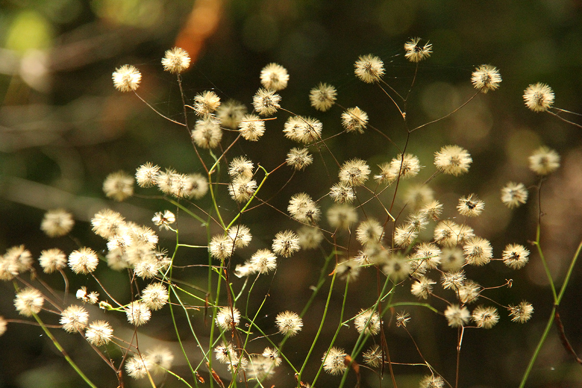
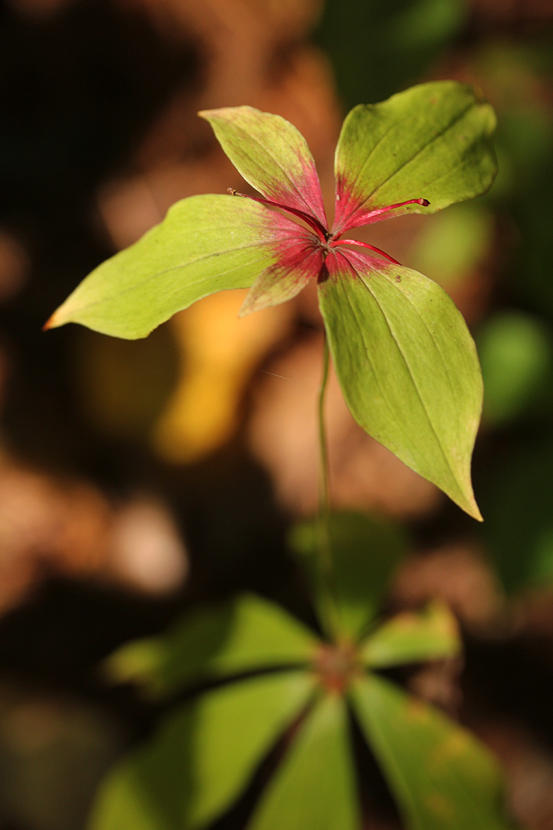
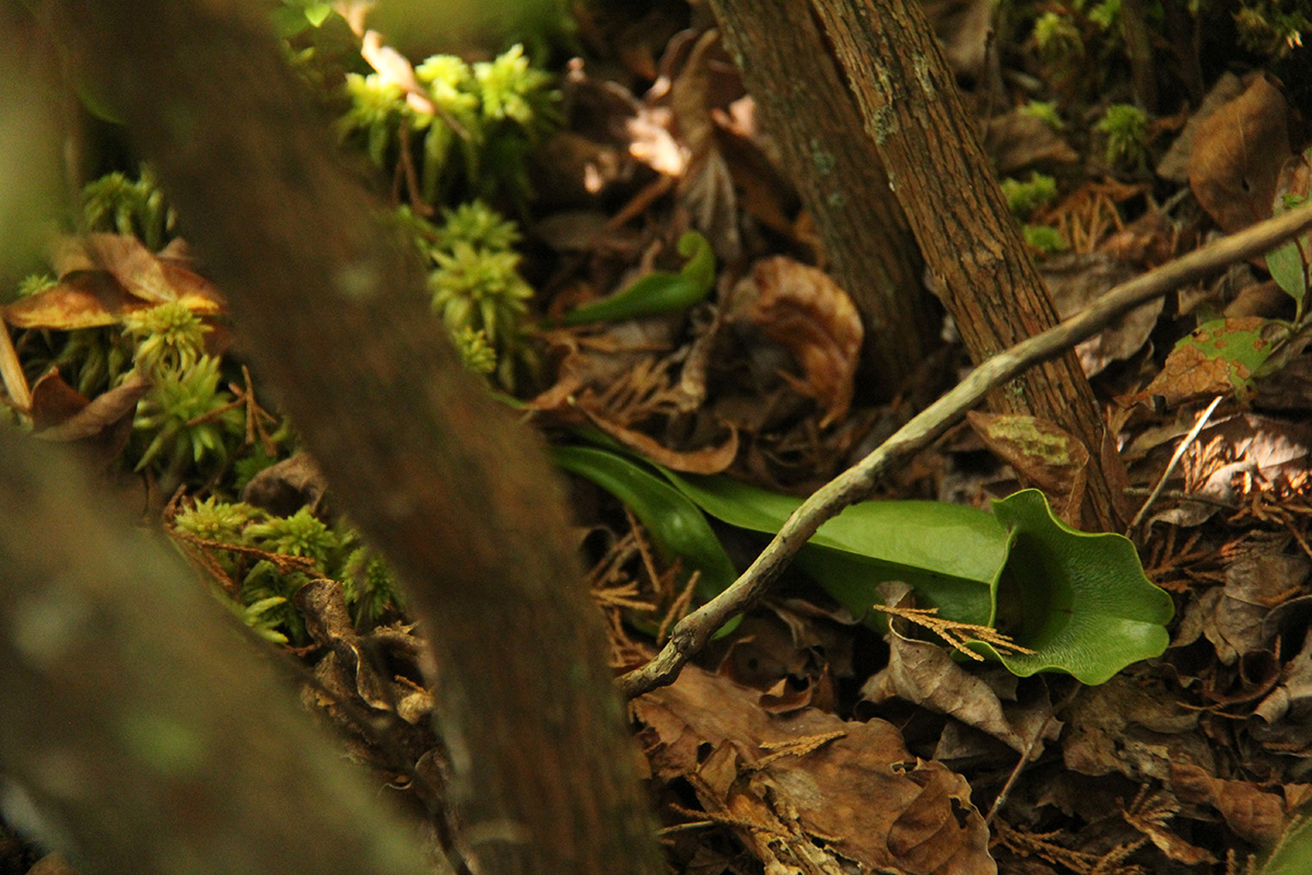
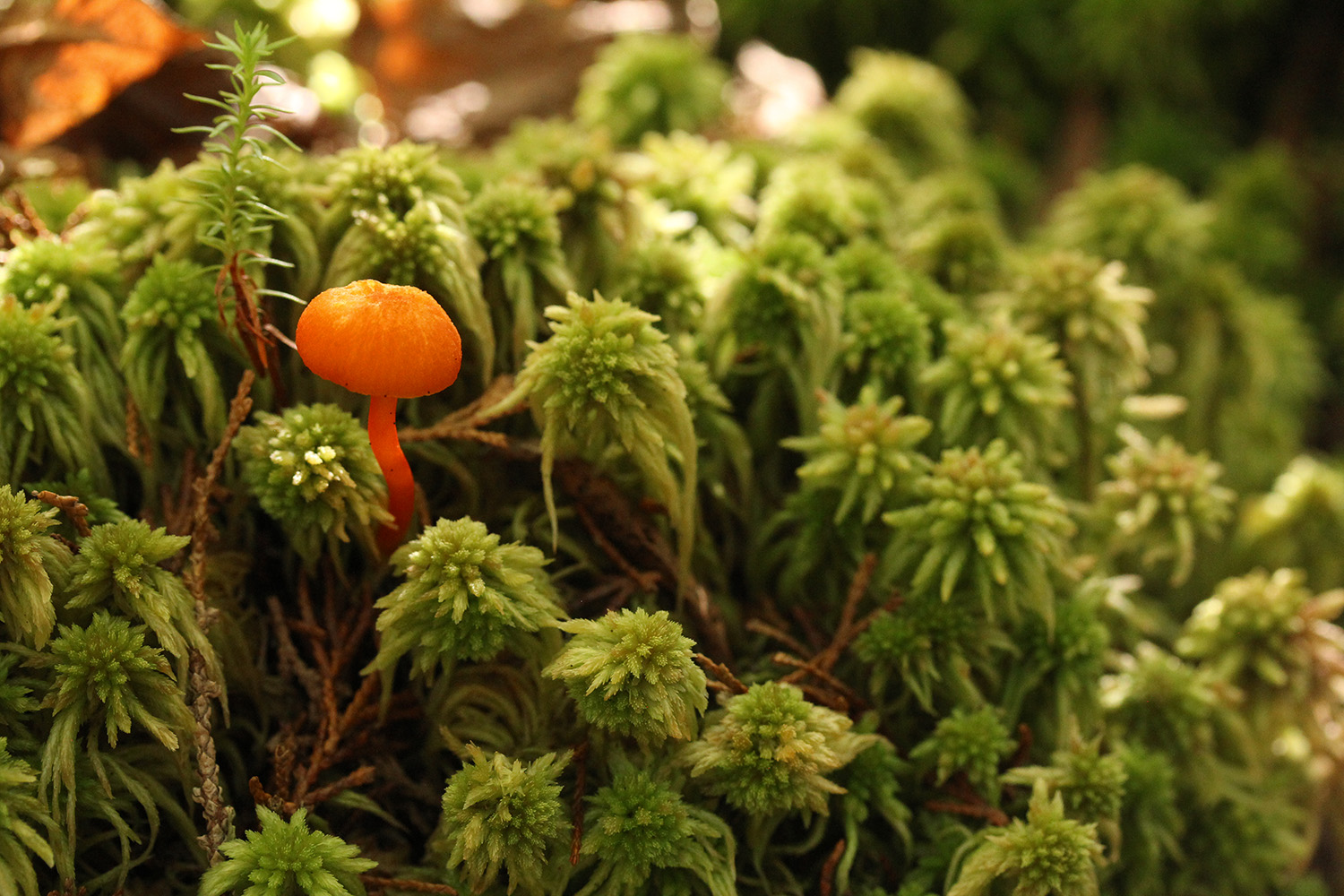
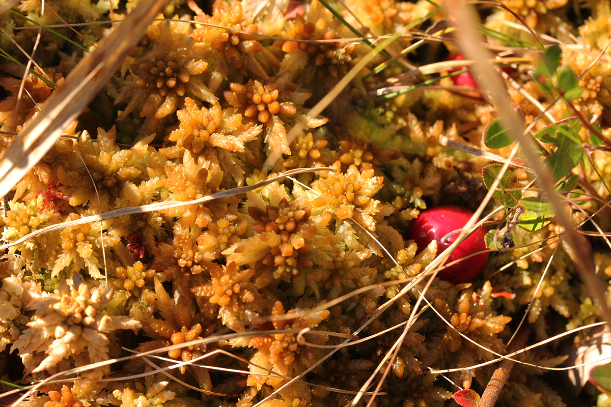
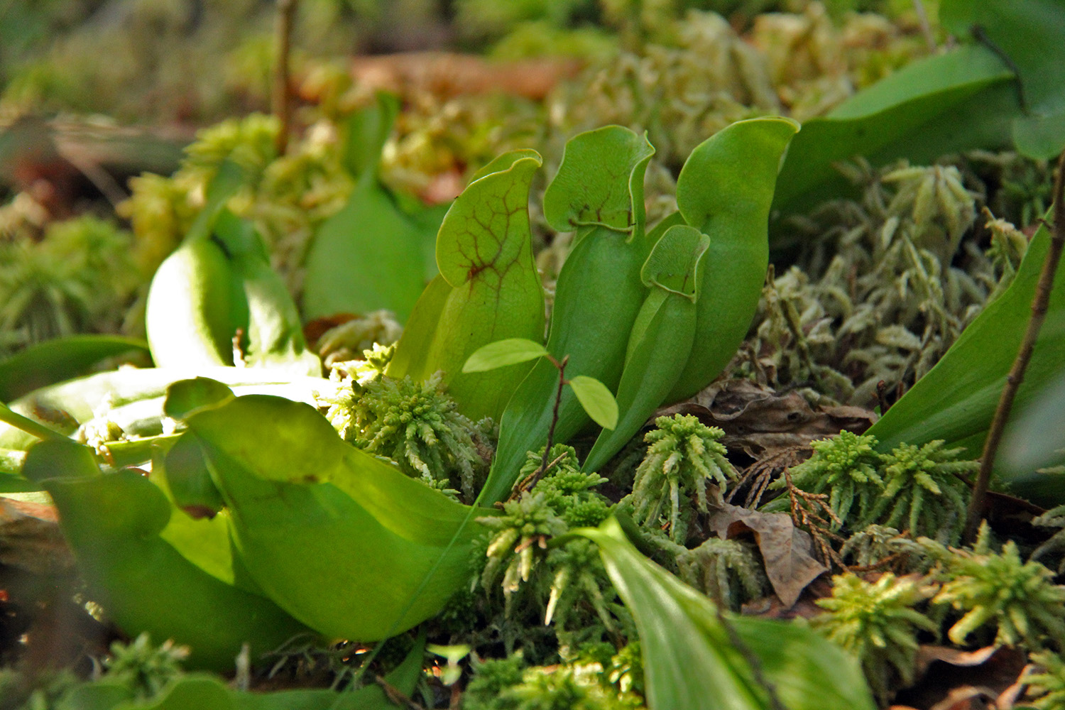
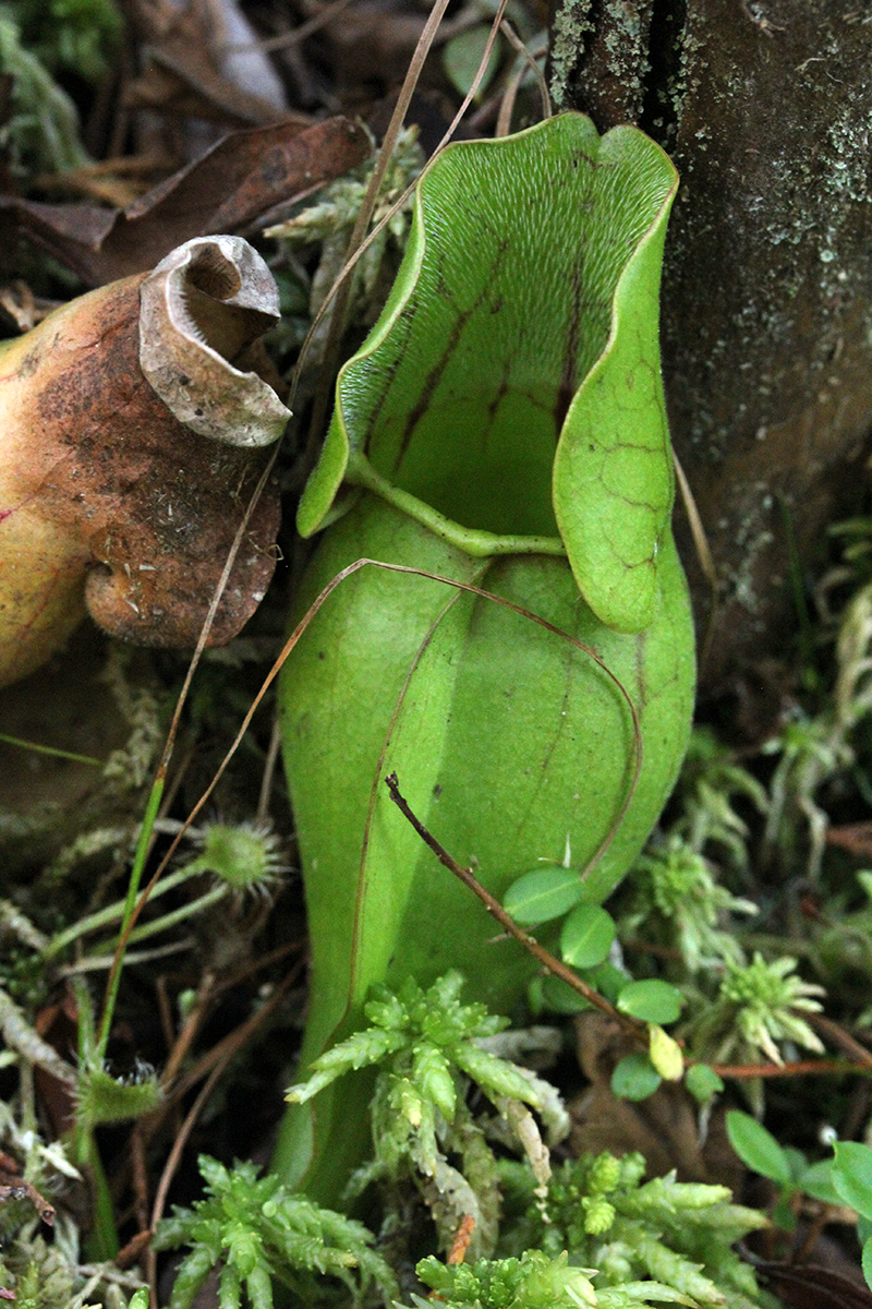
ponkapoag bog in canton (although i always think of it as quincy) used to be my favorite nature spot. it's quiet, secluded, has a great atmosphere, and the kind of things you see there (e.g. carnivorous plants) you can't easily see anywhere else. i used to go at least once a year (if not more) but my last visit was 2008, and only because i was coming back from a meeting in norwood. it's really a hidden gem for naturalists, and few enough people visit that an image search for "ponkapoag bog" brings up several old photos i've taken there.
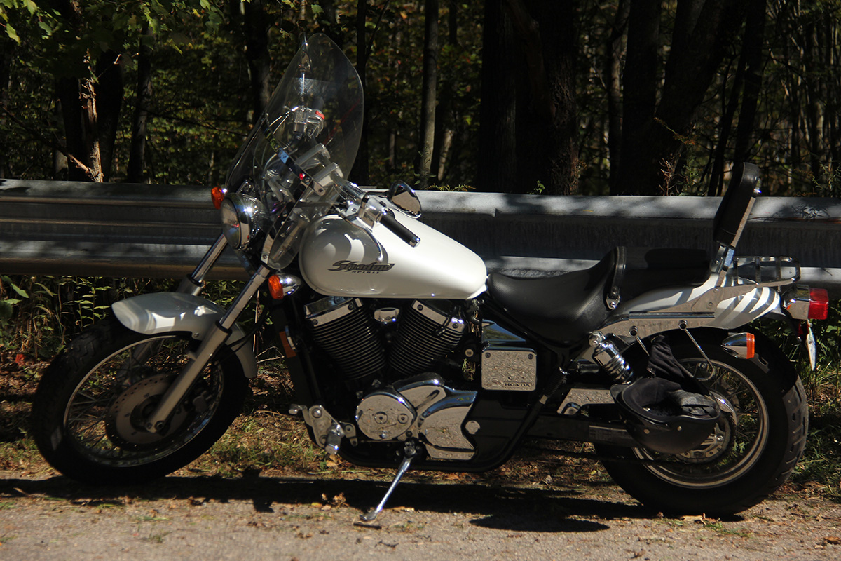
so with the growing season winding to a close, and with a bout of unusually warm weather (temperature in the lower 80's), i decided to revisit my once favorite nature spot. approximately 17 miles south, getting there would take me about an hour via motorcycle. google map suggested some highway routes that would take just half an hour to get there, but i always take the smaller (slower) roads on the bike, and went the way i used to go, through JP, across the arboretum (route 203 morton st), down blue hill avenue (route 138). getting to JP wasn't hard, but i haven't been on 203/128 in a while, and carefully studied the route last night in preparation.
 somerville road crew were tearing up the end of the street again. not quite sure the reason, but they've worked on that one spot a bunch of times before. they had to redo it one time because the drainage was too high and the end of the street flooded. then it became too low, dangerously so, that it's very hard to see around the curb for oncoming traffic. so i'm guessing that was the reason they were redoing it once again.
after a grilled cheese and ham sandwich for breakfast, i left a bit after 11am. i left a handwritten note on my laptop saying where i was going, just a precautionary measure in case i went missing. i should've left even earlier, but i figured i'd arrive sometime after noontime, with still plenty of hours to spare before i needed to head back in order to avoid the rush hour traffic. as far as lenses, i brought: 18-200mm telephoto, 60mm macro, 10-22mm wide-angle. i also brought my fuji 3D camera. all this equipment i didn't have the last time i visited ponkapoag in 2008 (i was still using my rebel XT, i didn't upgrade to the 60D until november 2012), with the exception of the 60mm lens, so i was excited to photograph the bog with a new set of optics.
i rode through JP back in late august when i went to the caribbean parade. the jamaicaway wasn't bad, i'm still surprised the posted speed limit is only 25mph when everyone seems to be driving 45mph or faster around the many curves. i connected to the arborway (route 203) with little trouble, correctly navigating the twin rotaries between jamaica pond and the arboretum. crossing washington street i got a little confused. because of the construction work around the forest hills MBTA stop, i wasn't sure if i was supposed to keep on going straight (the arborway) or take a right (washington street). both seemed familiar, but i kept going straight, figured if i got lost i would stop to check google maps on phone later. i ended up making the correct decision, as going right would've taken me to roslindale and then route 1 norwood (that's why it seemed familiar).
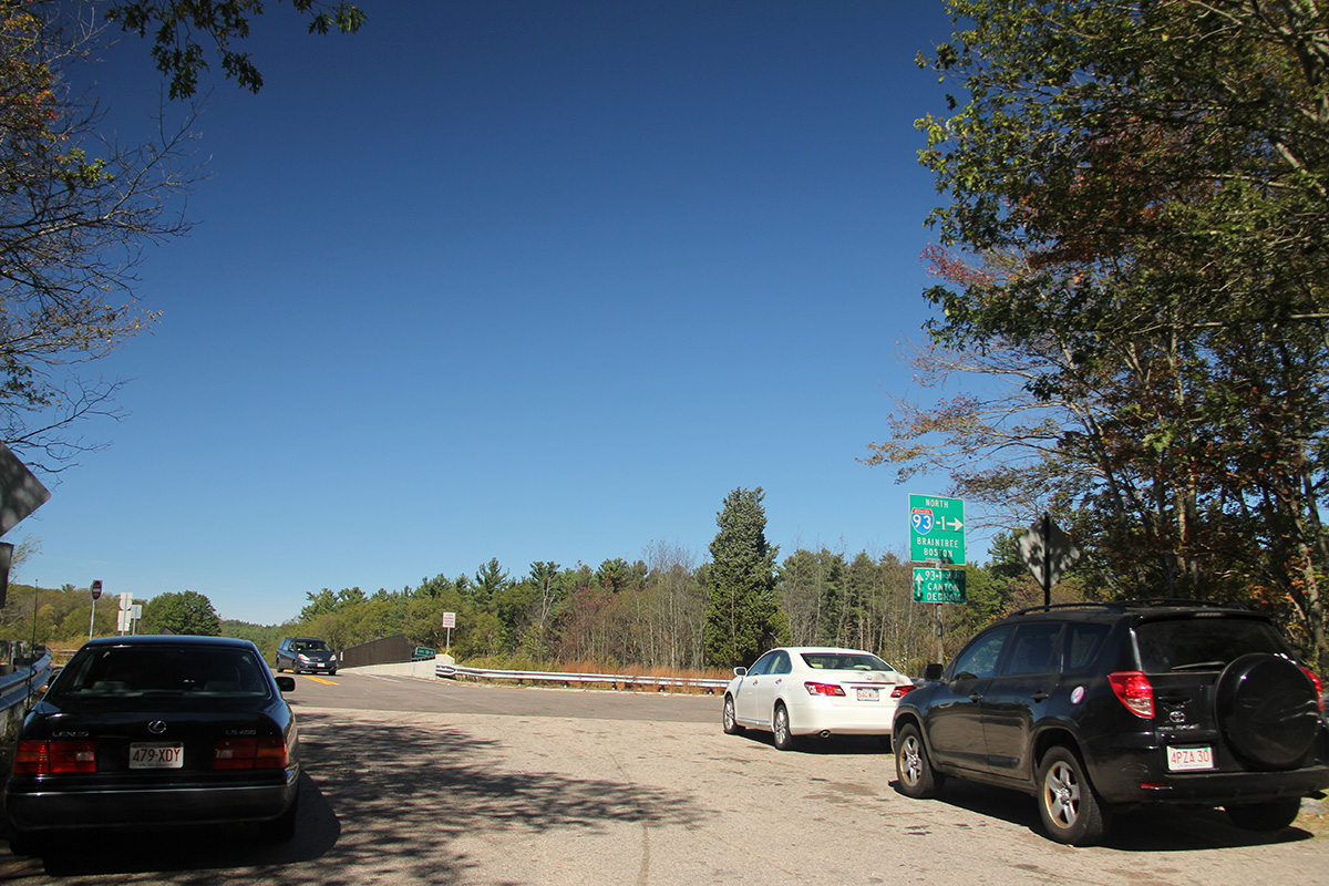
i was on the arborway for 2.6 miles (it becomes morton street at a certain point) before i hit blue hill avenue and made a right turn. once again i was a little confused, as the signs said i was heading onto route 28. but route 28 becomes route 138 after mattapan square. but i saw the intersection last night on google street view, so i knew i was going the right direction. by the way, there seems to be some cool restaurants in mattapan square, i'll have to come back at some point to check them out. the route gets a little tricky after mattapan square, as the road split into 3: brush hill road, blue hill avenue, and blue hills parkway. the correct way is to follow blue hill avenue (route 138), the center road. i rode on blue hill avenue for about 6 miles before coming to a large intersection where i could see route 93 up ahead. that's my cue to a take left, onto blue hill river road, follow that road for 1.5 miles, where it finally ends at the entrance to ponkapoag bog. i arrived a few minutes after 12pm.
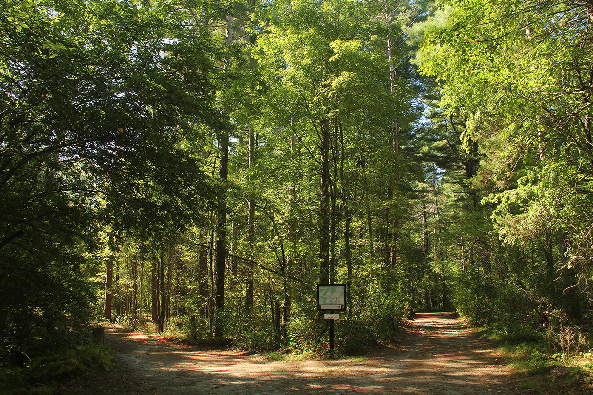
there was 3 cars parked outside, along with a street sweeper truck. that's actually more traffic than i was expecting, as typically ponkapoag bog is near empty on a weekday. i took out my camera, took a swig of hot yogi tea in my contigo tumbler, and walked into the reserve. i saw a main running the trail back out to the entrance, and a woman walking her miniature collie.

 Lorem ipsum dolor sit amet, consectetur adipiscing elit, sed do eiusmod tempor incididunt ut labore et dolore magna aliqua. Ut enim ad minim veniam, quis nostrud exercitation ullamco laboris nisi ut aliquip ex ea commodo consequat. Duis aute irure dolor in reprehenderit in voluptate velit esse cillum dolore eu fugiat nulla pariatur. Excepteur sint occaecat cupidatat non proident, sunt in culpa qui officia deserunt mollit anim id est laborum.