 |
 |
 |
after waking up at 5:00 to drop off my parents in south station for their new york city day trip, i came back home and took marco to noanet woodlands in dover around 10:00 to do some leaf peeping. even though it was late in the season, there was still a surprising amount of color in this oak-beech-red pine forest (maybe because oaks retain their leaves much longer). we also made it to powisset peak (my first time) directly southeast in neighboring hale reservation after bushwhacking our way through an unmarked trail. powisset has a better (unobstructed) view of the trees below and we had the whole place to ourselves. lashed by the winds, we snacked on some beef jerky before making our way back down. while marco left for a run, i returned the car. later in the evening my parents called to let me know they were going to take the bus back to belmont, no need to pick them up.
after only 3 hours of sleep, i was up at 5:00, on my way to belmont to drop off my parents at alewife station for their new york city day trip. dawn wasn't until another hour but there was already a hint of brightness on the horizon. ideally my sister would be able to drive my parents, but she can be unreliable at times. my parents were originally going to drive themselves and pay to park, but i told them to save their money. since it was still early, i suggested driving directly to south station instead of just dropping them off at alewife.
although i volunteered, my father ended up driving to south station. once there, i drove the car home. i was already by the aquarium when my phone rang. my father asked where i was. i already knew what he was going to ask before he even asked it: he wanted me to come back to south station. apparently while backing out the other cars from the driveway, he took all the car keys with him. i raced back and found my livid mother standing outside, who then handed me the keys.
the tank was almost empty so i gassed up at the hess station on the corner of prospect and hampshire in cambridge. i then drove to belmont to drop off the keys before returning to my own place with the car. it was around 7:00 and i could've gone back to bed but i wasn't particularly sleepy. i was however hungry and heated up some chicken noodle soup from a can for breakfast.
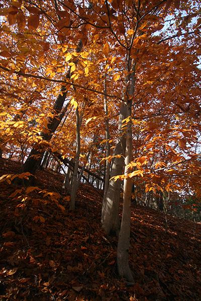
marco got up a little bit after 9:00. he was ready to go by 10:00. i was taking him out to see some fall foliage. it was already peak colors (maybe even a little post-peak) and i was afraid if we waited another week all the leaves would be gone. i decided on noanet woods in dover, the place i took pau last october, a location where i've had good viewings in past autumns.
 |
 |
 |
 |
we followed the red blaze trail, veering left (marker 33, 32, etc.). i didn't find it the last time i was here, but i wanted to see the large table top glacial erratic (located at marker 28). from there we climbed over a beech covered hill to get back on the trail between lower and upper mill pond.
 |
 |
 |
 |
 |
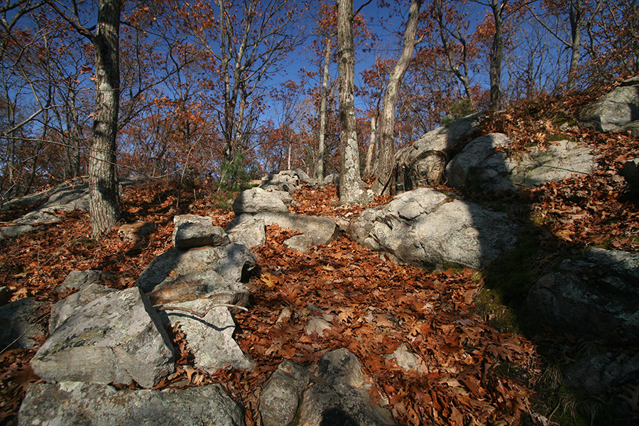
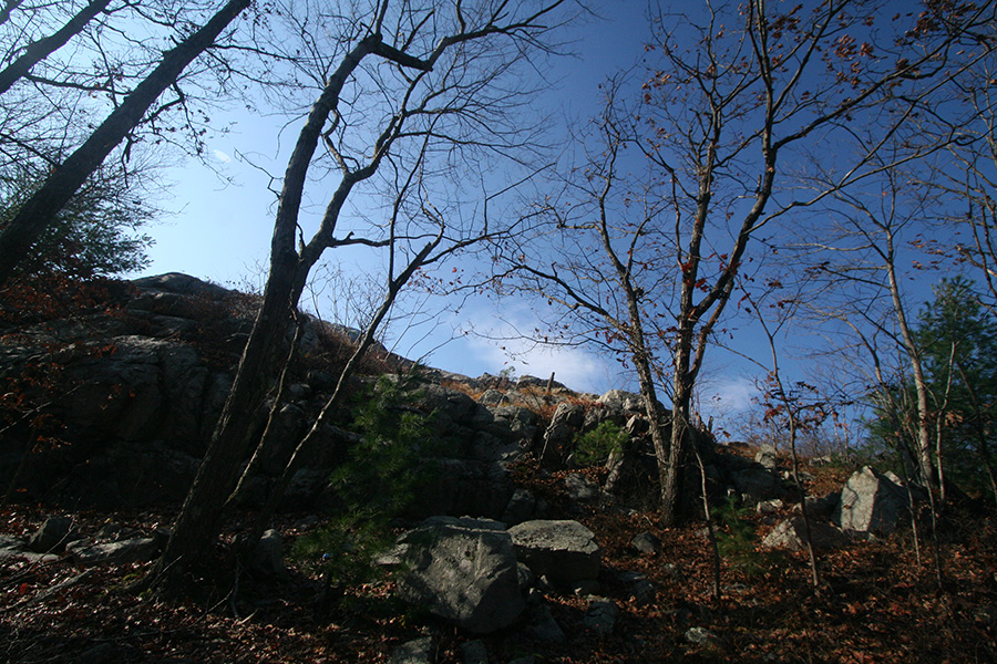
at marker 36 we followed the yellow blaze to noanet peak trail. i didn't know what to expect. all throughout the forest we didn't see a lot of colors. most browns from the oak trees and the occasional yellow-orange of the beeches. once we reached the summit (elevation 387 feet) though, we were pleasantly surprised by the kaleidoscope of autumn foliage.
 |
 |
 |
 |
 |
 |
 |
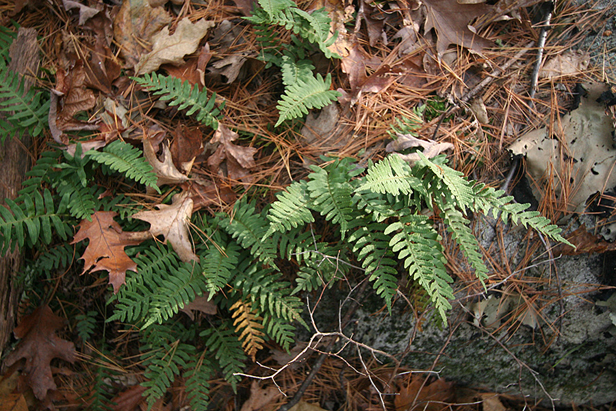 |
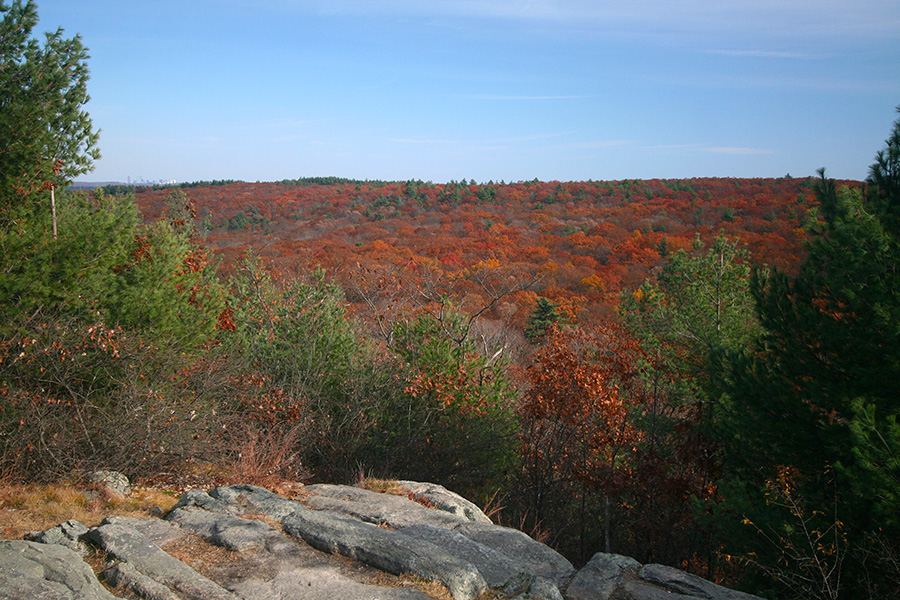
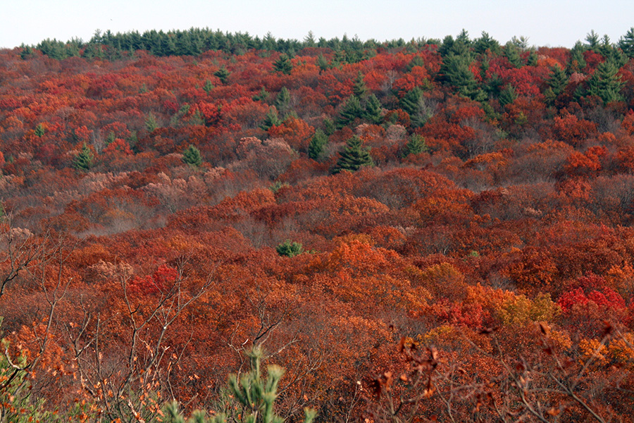
most of the colors was from oak trees, which could range from bright orange to burnt umber to brown. white pines punctuated the foliage with their evergreen steeples. even in area where the trees have already lost all their leaves, their bare branches resembled grey smoke or fog from this distance. at one point a vulture actually slowly soared overhead, the closest i've ever come to seeing a vulture in the wild.
we had the peak to ourselves for a short while before people started arriving. first a couple of teenage girls who didn't even bother saying hello. then a large group of young parents with children and friends. i told marco about another summit on the other side of the forest, that i've been meaning to check out but never got the chance. since it was still early (just around noontime) and marco seemed to be game, we decided to try and find this other peak.
we came down the shorter but steeper side trail south of noanet peak (abundant in beeches, many already without leaves). we then kept going southeast, within view of third iron company pond. here the trail went uphill until we came across marker 21. it would've been a simple matter of continuing east, but for some reason the trail does a roundabout north-south turn. we thought about bushwhacking it but decided to play it safe and stick to the path. we came across marker 22, with an eastern side trail not on our map. instead of going further north to find marker 23, we decided to take this side trail.
 |
 |
 |
 |
 |
|
 |
 |
 |
 |
although there was a trail, there seemed to be a lot less maintenance since we passed by several downed trees just blocking the path. once we arrived at a 4-way intersection we were met with an informational placard showing 2 trail maps, one for noanet woodlands, the other for hale reservation, the property where powisset peak was located.
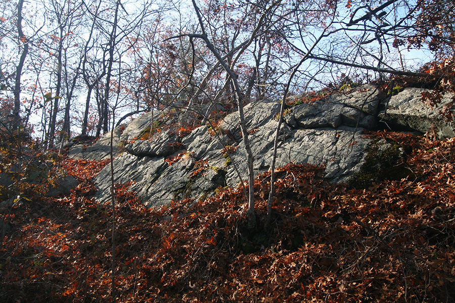
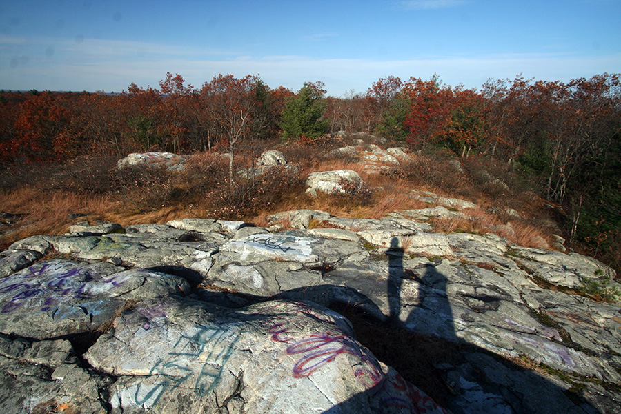
we kept going, taking an educated-guessing right on an unmarked trail, followed by another right. we seemed to be going uphill (a good sign) but then started going downhill again, before going up once again. we climbed a large rocky area thinking it was the summit but it was surrounded by trees. was this it? but i could've sworn i was able to see the peak from noanet. we kept on going, although slowly starting to lose hope. finally we came to another clearing. even though we couldn't yet see the other side, it was promising. once we climbed over the rocks, we were at powisset peak.

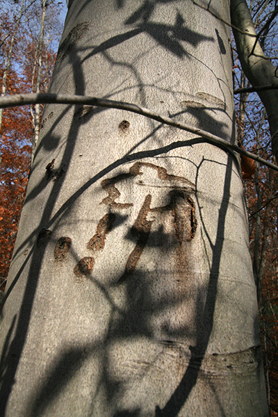
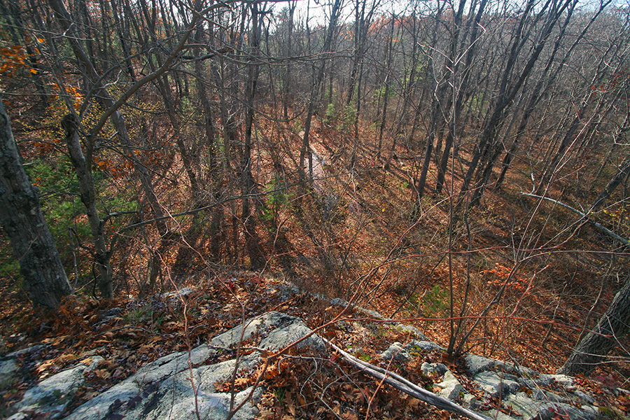
unlike noanet peak, where the nearby trees have started to obstruct views of the landscape down below, there was none of the same problem on powisset peak. not only was powisset higher (elevation 400 feet), but since it's relatively unmarked on the trail maps, not many people seem to come here and we had the whole place to ourselves. not to say people haven't come in the past, because there was graffiti all over the rocks and several crushed beer cans.
 |
 |
 |
 |
||
 |
 |
 |
 |
 |
we retraced our steps to get back into noanet woodlands, onto the marked trails. we went by the mill ponds then followed the other half of the red blaze trail back to caryl park and to the parking lot.
 |
 |
 |
it was later that i discovered they've changed some of the trails. the map i had was from october 2003; the new one online is dated september 2010. even though at times the actual trails didn't match up with the map that i had, in hindsight having the older map was actually a blessing because it had information about powisset peak, which is missing from the new map.
before we left the parking lot i actually found a tick crawling on my forearm. "you might want to check yourself when we get home," i told marco. heading back i used the GPS but i didn't follow the directions, instead going my own way. the GPS kept wanting me to take the turnpike but i wanted to stay on the smaller side roads.
once in cambridge marco went out for a run while i returned the car to belmont. nobody was home but several lights were still turned on. i motorcycle back.