
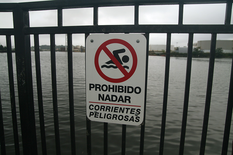
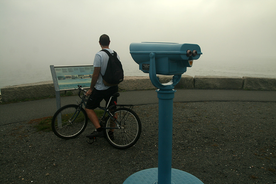
marco and i biked to deer island in winthrop today, a distance of 11 miles (more like 13.5 miles due to numerous detours), not including the nearly 3 mile loop around the island, and the return trip home (a total of more than 30+ miles). it didn't seem so far on paper, but navigating through 11 miles worth of city streets required a nearly exhausting amount of concentration. we left around noontime and didn't get back until sometime after 5:00. my butt is so sore from all that riding that i may not be able to sit correctly for a while. i knew how to get into east boston, but once we were there, we did get a little lost trying to find saratoga street from condor/eagle. and when we arrived in winthrop, it took us a while to finally get to deer island. did i mention it was an unusually foggy day? on the island, we could only see a few hundred yards at the most, and the horizon and the sky merged into a disquieting screen of whiteness. we could only see the digesters when we stood next to them. fortunately by the time we made it to the southern tip, the fog lifted a little bit for us to see a few islands, before coming back again.
travel notes:
negotiating the sullivan square rotary involves crossing 3 busy streets of merging oncoming traffic, with only a single crossing with lights. be prepared to wait.
just as i hoped, the everett industrial zone wasn't as crowded on the weekend. it was still unpleasant to traverse, made worse by numerous dirty water puddles from last night's rainstorm. instead of wandering onto 2nd street, we managed to stay on course and go down williams into chelsea.
 we took a detour down broadway and then the waterfront park to get a closer look at the tobin bridge. marco seemed to be thoroughly impressed with the size and length of the bridge (1950 cantilever truss 2+ miles long). "everything is bigger in america,"i told him.
 crossing into east boston, we stopped at the condor street urban wild site. from here you can get a lovely view of the chelsea river and a large parking lot across the water.
we got lost trying to find saratoga street, the straight-away that'd take us into winthrop. maybe if i had a clearer map this wouldn't have happened, but on the printout it was hard to see and we ended up on chelsea street heading towards the bridge that's no longer there.
eventually we did find saratoga street. i thought there'd be a dedicated bike path but there wasn't one. at orient heights circle we stopped to check the map again to make sure we were still going in the right direction.
 we stopped at a rite aid so i could get something to drink. from there we took a detour up teragram street to bayswater next to (surprise surprise) the water, across from logan airport. we followed the street until it came out onto saratoga again. we crossed the bridge into winthrop.
instead of following main street, we went north to morton street, facing some marsh lands. we kept going until we went down the wrong direction of one-way wnthrop street. we followed main passed the high school and then went around the gold club. around this time the fog became even thicker. it was misty, it was warm, it was humid - it felt like being in a rain forest, minus the rain forest smell (more like seashore). we went east until we hit winthrop shore drive and followed the beach southwards.
 |
 |
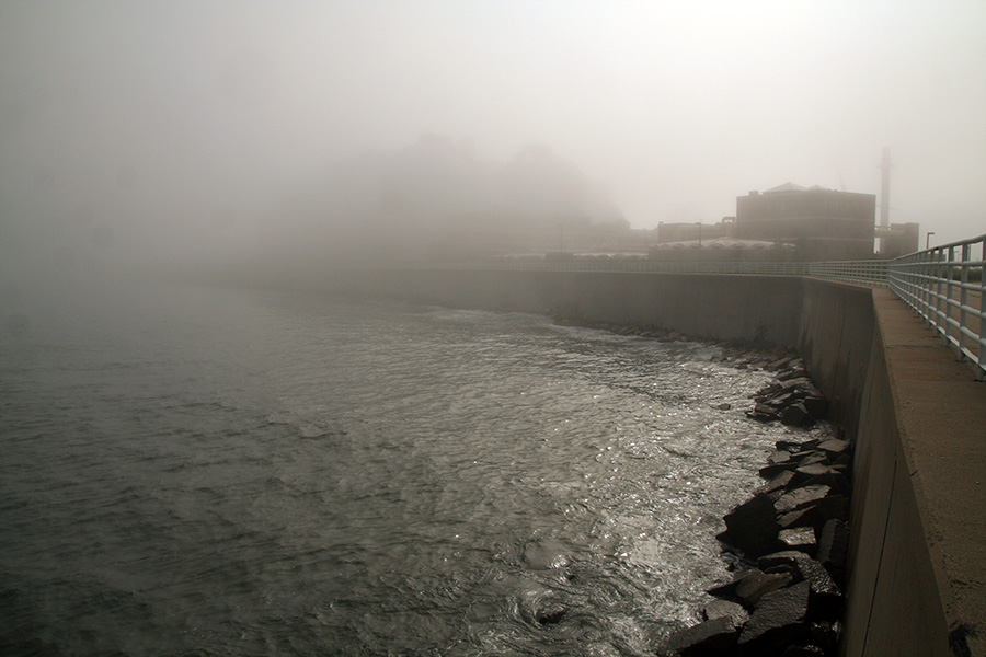
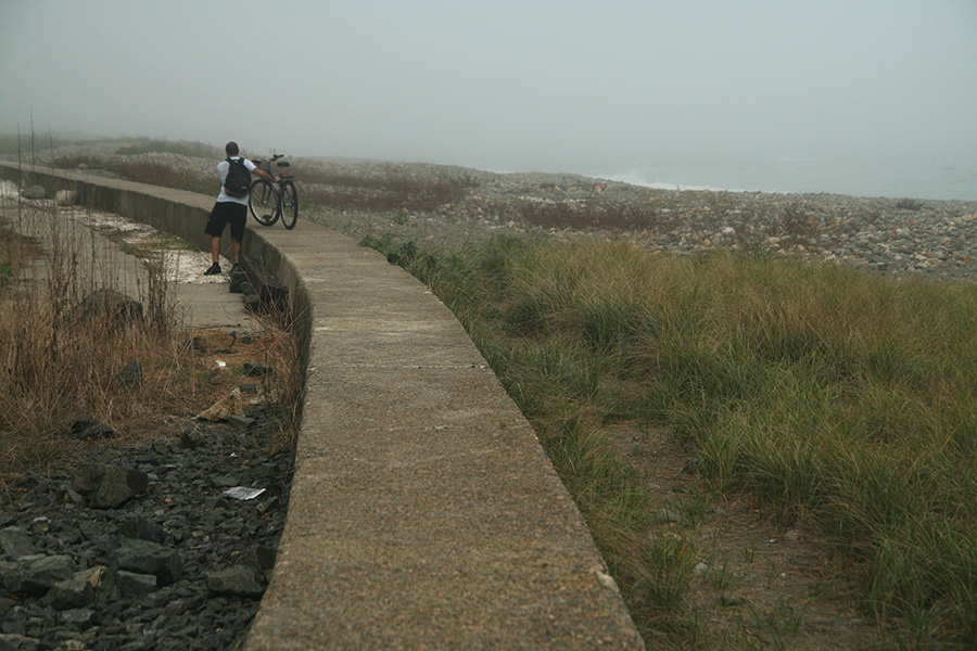 at the end of shore drive, we climbed the seawall with our bikes and continued south. it was dangerous and we decided to turn back when it looked uncertain that the seawall would safely bring us to our destination.
we crossed west on beacon street until we got to the western shoreline of winthrop. we followed shirley and kept on going south until we finally arrived at deer island.

 |
 |
 |
 |
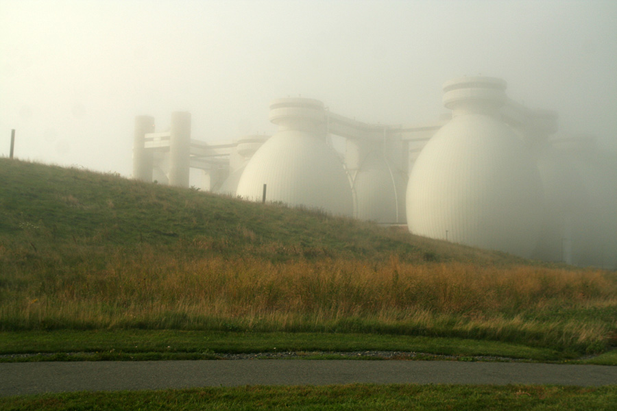
the last time i came to deer island, visibility was so clear that bruce and i thought we saw provincetown. this time it was the exact opposite.

the fog wasn't without its beauty however. it made the landscape seem like a dream. catching glimpses of the egg-shaped digesters made them look that much more mysterious and futuristic.
 |
 |
 |
 |
 |
|
 |
 |
 |
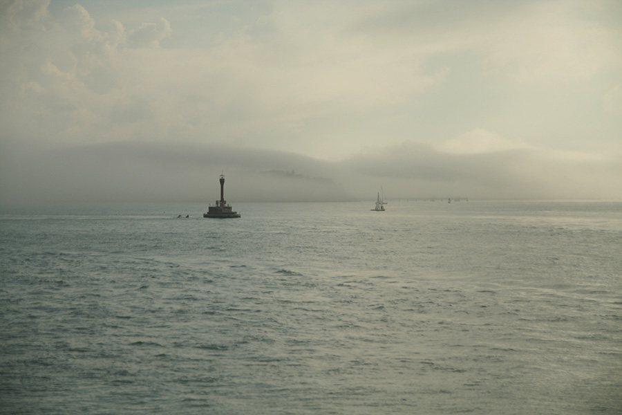
 at the southern tip of deer
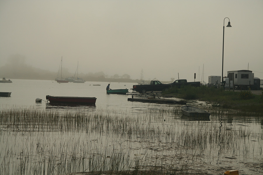
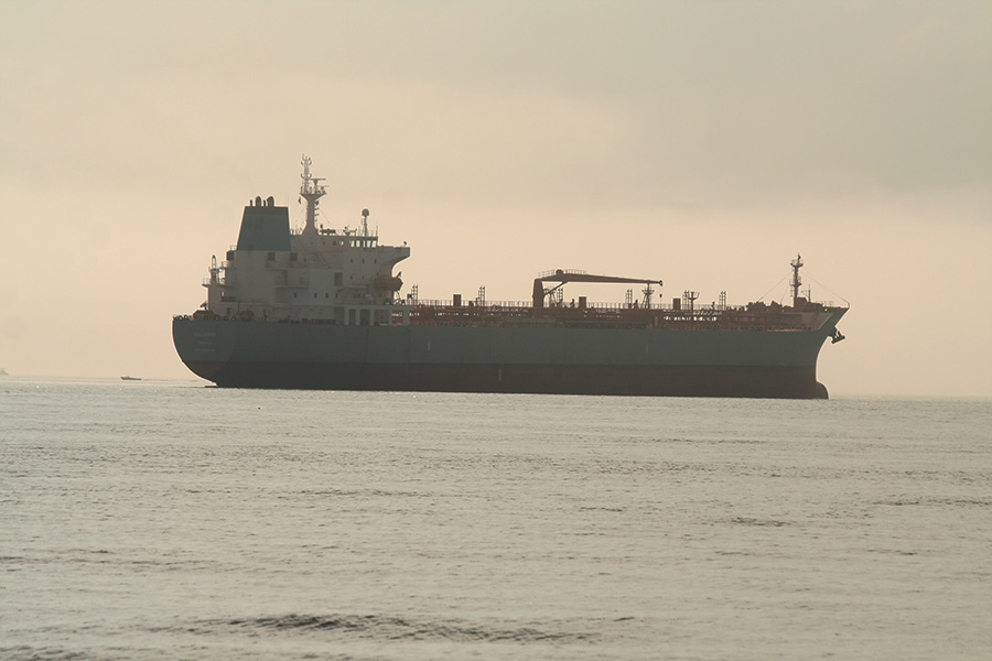
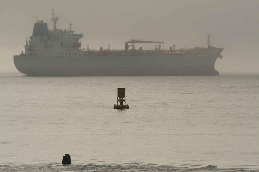
  island the fog was so thick that the water and sky was a wall of white mist. although we couldn't see anything, there was a lot to hear, including ship horns and buoy chimes. off on the horizon there appeared to be a large island which turned out to be a tanker ship when the fog lifted a bit. this was the galissas, flying the panama flag, on its way to klaipeda, lithuania.
 |
 |
 |
 |
 |
 |
it seemed like it took forever to bike to deer island, but that was only half the journey; now we were faced with the task of riding home. in theory this should be easier since we'd be returning via the same route.
 |
 |
 |
 |
 |
|
 |
 |
 |
on winthrop shore drive we stopped so marco could get a chance to dip his toes into the atlantic ocean. "cold," he said. we got back onto shirley street via coral avenue, then southwest on revere street to get onto main.
 at the end of saratoga street in east boston i asked marco if he wanted to get some late lunch. he was happy if we just went home and i thought that was for the best, since i didn't want to be stuck in east boston come night fall. not because of any inherent local dangers, but just because it'd be harder to see the streets and there was still some ways to go, especially trying to navigate the everett industrial zone.
in the future i may be tempted to go around the industrial zone. it may add close to another mile to the trip, but it might make for a nicer ride.
coming into somerville, we cut through market basket. i asked marco if he needed to get some groceries, he said he'd do it later (which seemed counterproductive, since we were already there).
after an hour of rest at home, i went with marco to do some grocery shopping. we both got rotisserie chickens for dinner. marco bought so much stuff that my rear backets couldn't hold everything and he rode back home holding a bag of groceries in one hand. it was also dark by then and i didn't bring lights; fortunately marco brought his: i had the headlight while he wore the taillight.