
the place i selected to go naturing was mount pisgah in berlin (massachusetts), about a 30 mile ride from cambridge. i managed to wake up a little bit earlier than what i set my alarm to (10:00). i got some breakfast, took a shower, and took a look at the directions one last time before leaving by 11:00.
that there's a town in massachusetts called berlin must be pretty amusing for germans. i couldn't find any information about how the place was named although the official pronunciation of the town name rhymes with "merlin." mount pisgah has a funny (and rude-sounding) name too, with unknown etymology. it's also not so much a mountain as it is a hill (715 ft), but with massachusetts being relatively flat, a hill can seem like a mountain.
even though 30 miles is not that far, it still takes more than an hour to get there, with much of that time spent just trying to navigate out of the city limits. that stretch of route 20 although waltham's main street is notoriously awful for it's congestion and alternating left/right-turn-only lanes. that combined with my residual post-traumatic twitchiness resulting from my last motorcycle accident and navigating the entire route from memory made for a harrowing ride.
i picked today because i knew it'd be a gorgeous day. every so often i'd pass by a bank with a digital time/temperature display: 81°, 82°, 84°. it seemed to be getting warmer as the day wore on. although i'm sure i'll get sick of the high temperature soon enough, for now it was a welcomed comfort following several days of less than optimal temperatures. i could feel my arms baking, well on my way to sporting a deep farmer's tan.
i traveled west on route 20 (the historical boston post road) until i got to wayland center, where i then took a right turn onto route 27. i stayed on 27, kept going straight until i reached route 62. during that stretch i actually hit some familiar roads, the route i'd normally take to get to the assabet river national wildlife refuge area. i saw they were still doing major construction there1, and i was glad i didn't pick that place for naturing.
since i had too much equipment already in my bag (3 camera lenses, a flash, a poncho, bug spray, bottled water), i slung my camera across my shoulder. 2/3 of the way into my ride, i reached over for my camera and noticed a subtle difference: it's protective neoprene case was missing! must've blown off during my ride. this is actually the 2nd time i've lost the case2.
after passing through the towns of waltham, weston, wayland (where i did most of my naturing last year),  sudbury (where i broke my foot in my 2008 motorcycle accident), maynard, stow, hudson3, i finally arriving in berlin. i couldn't tell if there was a parking area through google map street view, so i had a backup plan involving an alternate parking/entrance a few miles away. i did find the parking area, only because there was already a car there.
i went through my pre-naturing ritual: mount the proper lens, spray bug repellent all over my head and hands, and putting on my poncho4. i was parked at the northernmost point of the reserve, and started walking down devine trail (only on paper does it have that name; there are no markers other than a plowed path next to an emerging hay field). the path eventually came to a brook and that's where i lost the trail. not yet inside the forest and i'm already off course! i went right on what i thought was a path only to come to a dead end. i returned to the brook and decided to try going left. like some kind of naturing magic, that's when an old man dressed in business casual clothing suddenly appeared, walking across the field in my direction. i waved hello and asked him if he knew where the trail was. he pointed to a sign all the way across the field. i still couldn't see it but knew i was heading in the right direction.
 |
 |
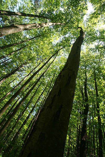 |
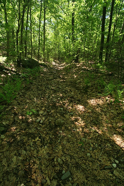
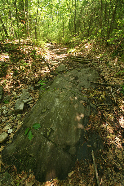
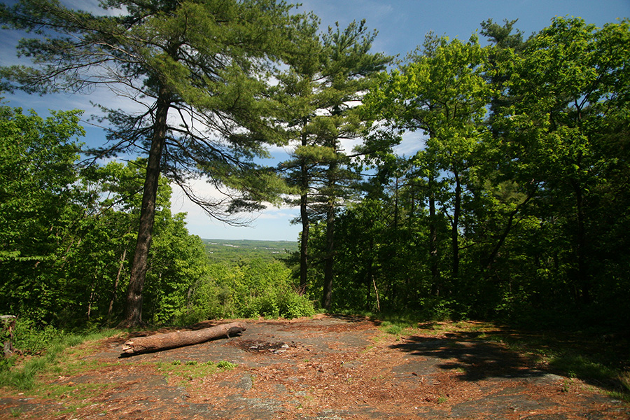
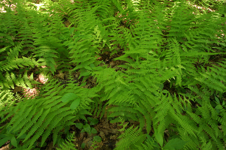
finally on the forested trail, i continued my southward hike. the paths were nothing more than trampled leaves and strewn rocks, the kind i like best because it's all natural. i initially hesitated in picking mount pisgah because almost all the trails were in the forest. that meant for much of the time i was in the shade, which made for a comfortable walk on this hot day, but there wasn't much in terms of wildlife diversity, since there are only so many plants that can survive in the understory.
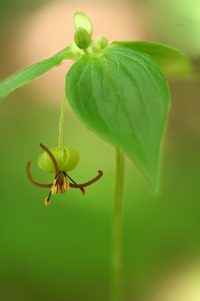
if there was one thing that broke up the monotony, it was the several hundred blooming ladyslippers (or as bruce and i affectionately call them, "mansacks") dotting the landscape. i took several dozen photos initially, but once i began seeing so many of them, i grew jaded to their presence. the flowering of ladyslippers in late spring is one of those natural new england highlights that need to be experienced in person. seemingly out of nowhere, in the dimmest parts of the forest, suddenly emerge these brilliantly eye-catching pink orchids growing from long thin stalks. they have such a complex life cycle (involving a symbiotic relationship with a fungus) that it's extremely difficult to grow them domestically, and can only be enjoyed out in the wild.
 |
 |
 |
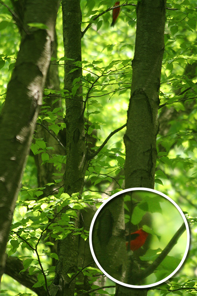
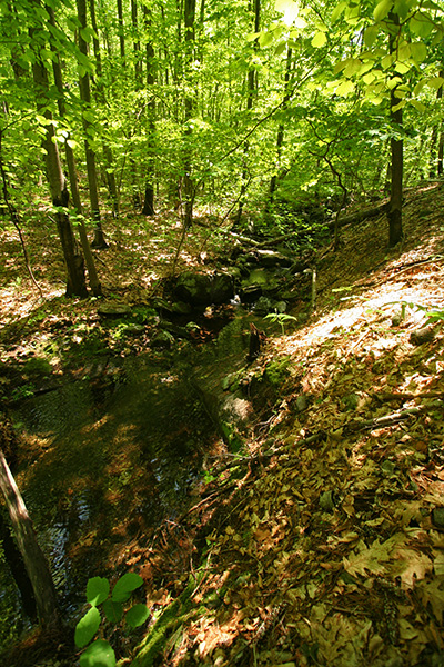
the wooded portion of devine trail runs parallel next to a stream. wanting to take some small waterfall photos, i made my way down to the brook. my careless crashing spooked a pair of drinking birds who flew up into the trees. catching only a glimpse, my intuition told me they were scarlet tanagers. these neotropical migrants are one of the prettiest, with males in their red plumage and females in olive-yellow. they like to hang out high up in trees so are hard to see, but they stand out so much (particularly the males) that once you catch sight of them they're easy to pick out.
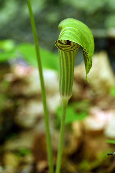
crossing over onto the other side of the brook, i discovered some jack-in-the-pulpit growing undisturbed behind some large boulders.
 |
 |
 |
 |
 |
 |
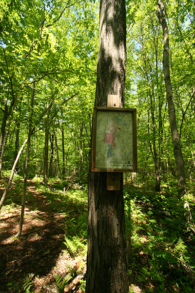
the trails weren't consistently marked but the paths were pretty obvious, so you couldn't really get lost even though you might not know where you were (does that make sense?). the various routes were identified by color-coded markers, which didn't do me much good since i just had a B&W laser printout of the trails. fortunately posted signs graced a few key intersections, and some even had "you are here" maps.
 |
 |
 |
 |
i managed to improve my wildflower identification skills. in the forest i'd often come across these whorled 2-tiered plants that i thought were starflowers. turns out they're actually something called indian cucumber roots, so named because their tuberous roots taste like cucumbers. they have pretty unusual looking flowers, and i managed to get a few photos which made me realize they were in fact not starflowers.
there were a lot of blueberries in pisgah, so this would be a nice place to go foraging later in the season.
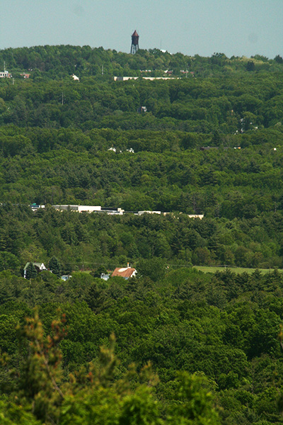
after devine, i continued on the north gorge trail (the path travels above the gorge to actually a pretty steep drop down below) until i eventually got to the north view vista point. from here you're supposedly able to see boston (30+ miles away) on a clear day but all i saw in the far distance was a water tower. this was my first break of sunshine i took advantage of it my stripping off my poncho so i could aerate.
 |
 |
 |
 |
 |
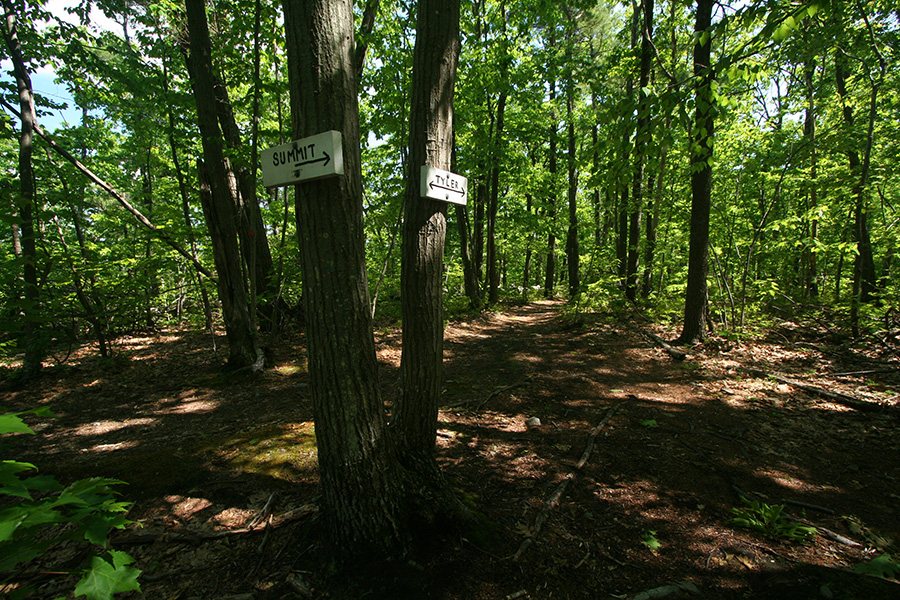
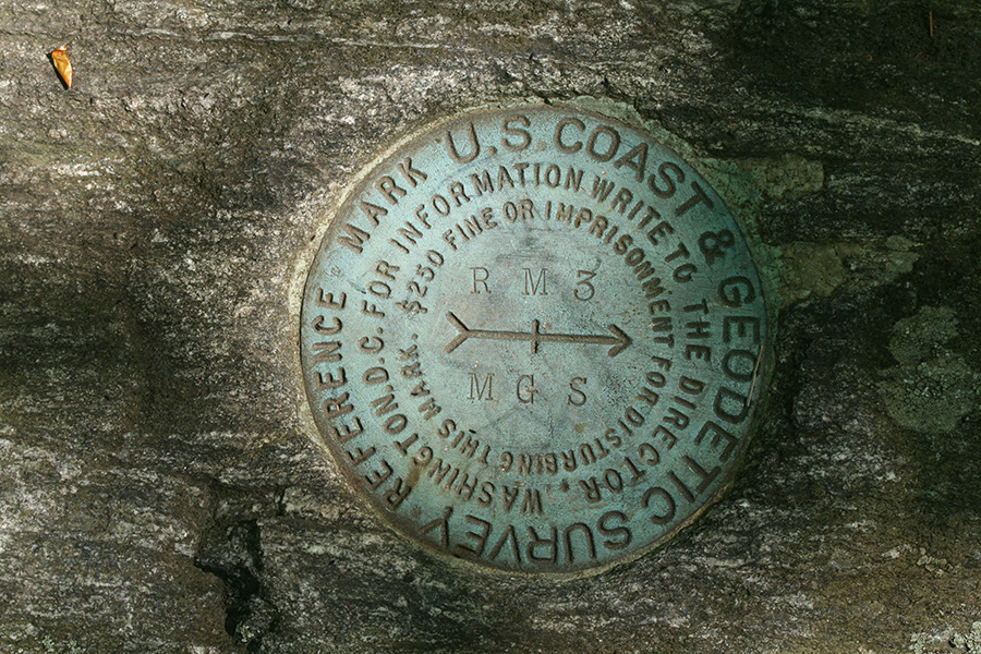
from north view it was a short distance to the actual summit of mount pisgah. even though it was nearby, it actually took me a while to find. one reason is by the time i saw a sign point to "summit", i was already at the summit point. the sign actually points to the summit trail, which leads away from the summit. searching around the broken rocks, i eventually found the USGS marker designating the exact summit point.
by then it was almost 3:00. not stopping for photos, i could make it back to my motorcycle fairly quickly (i was a little bit more than a mile into the forest), but then it'd take more than an hour to ride back and i didn't want to get caught up in rush hour traffic.
 |
 |
 |
 |
 |
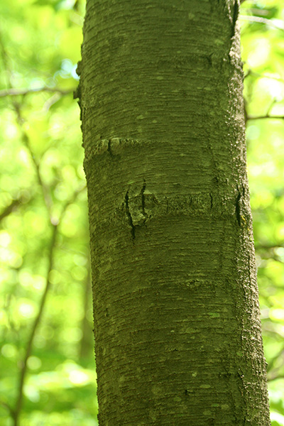
a few other noteworthy items: within the forest there were numerous large rocky outcroppings, but none had polypody ferns growing on them. i eventually found some, but they were growing by the base of a tree near a mammoth-sized rock wall.
pisgah is surprisingly free of the usual natural nuisances. at the parking area and along the field there were spotted instances of poison ivy, but once inside the woods, it was poison ivy free. i'd heard reports of an explosion in the tick population this season, but i didn't come across any, even during the bits of bushwhacking. as for mosquitoes, there were a few, but i had repellent on. i think the low mosquito population is due to the lack of any nearby swamps.
 |
 |
 |
i can finally tell the difference between a forest tent caterpillar, a normal tent caterpillar, and a gypsy moth caterpillar. forest tent caterpillars don't actually build tents (despite their namesake). they are however quite beautiful, a light blue worm with orange stripes and white spots. i still wouldn't want to touch them, with all those hairs!
i was hoping to see some snakes but didn't find any. they probably prefer a sunnier location. i did see a few amphibians though, a spring peeper (or maybe an immature wood frog, it was a quick look), and some toads. i also heard a light chorus of peepers near the gorge trail.
i spotted green tiger beetles but couldn't get any photos. i was on my way out anyway, and the effects of bug spray was starting to wear off, so i wasn't in a patient mood to stalk them. i did see several mourning cloak butterflies, and the one i found on the summit was territorial enough to circle around me and land for photos (none good, so none posted).
it took more than 30 minutes to finally get out of those woods. i drank the last of my water and prepared for the long trip back home. the ride back was uneventful. i'm always worried about the traffic but people are usually leaving the city by that point instead of going to, so there was very little resistance - that is until i got to waltham, which is always a congested mess. i tried looking for my dropped camera case, but didn't look too hard since it distracted me from riding (better to lose a $30 case than get into another accident). i finally made it back home by 5:00.
julie dropped by around 7:00 to deliver a box of milky way bars. she stayed for an hour chatting and catching up, before leaving. i finished the last of my pulled pork for dinner.
1 construction has been ongoing since last year, as they're making new roads and clearing chunks of conservation land to make way for a parking lot and a learning center. kind of sends a mixed message, i sort of wished they kept the place pristine like it was before. assabet was a great location for hunting dragonflies during the summers.
2 the first time i lost the case was in litang, western sichuan china. i left it in the backseat of a shady minivan driver who successfully shook us down in the middle of nowhere when he stopped the car to demand a fare increase. he didn't realize i had a cell phone and i called his boss to complain but it was no use. the "adjustment" was only a few dollars more per person, but it left everyone disgruntled about frontier style corruption. and i lost my camera case no less!
3 less than an hour after i passed through hudson, students in their high school cafeteria staged a massive food fight and police had to be called. coincidence?
4 i've gotten used to wearing a poncho while naturing, especially in the woods, in order to ward off mosquitoes, which can easily bite through a sweat-soaked t-shirt. either that or literally drench myself in bug repellent. when i'm out in the full sun i normally take off the poncho since there are less bugs.