spent a few hours doing some research for a possible project. never worked so hard on something that i'm not even sure if i'm going to get. i finally figured out a viable solution, but need to write a proposal tomorrow. looks like i'm going to be busy next week. a project for client S, and i need to get in touch with client B. i tried to get some instructions from them last week but they were mysteriously silent. i'm sort of worried that maybe they decided to go with somebody else for the project, so i need to call them up, figure out what's happening.
had dinner at my parents in the evening. hailey bit a hole in another one of my t-shirts.
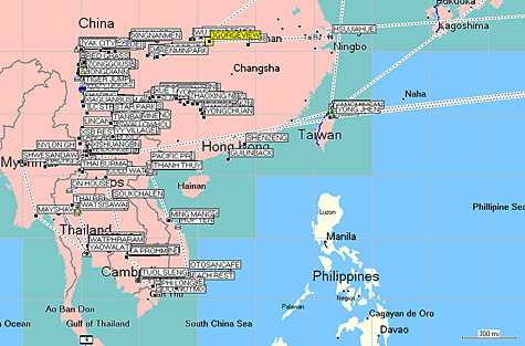
unsuccessful at installing the garmin mapsource program on my father's pc, i returned home to download the gps data onto my own computer. i never realized it, but during that two tumultuous years when i did a lot of asia traveling, i plotted waypoints wherever i went. i did it not because i wanted to be some amateur cartographer but rather just in case i got lost, i could always retrace my steps. i never bothered to take the time to check out all the waypoints until tonight, but looking back on it now, it's a bread crumb trail of my travels. the best part is merging the data with google earth, so i can view satellite maps of where i was. maybe i can combine the data with my photos and turn it into some web 2.0 project.


